Carreg Cennen Circular

I was unable to make the usual Monday walk in the company of “The Navigator” but remedied this by a walk today, Tuesday.

The route was taken from Alan Richards book “Great Walks in Carmarthenshire vol. 1” and we chose the Mynydd Du Tair Carn Isaf and Tair Carn Uchaf walk, or as I have called it in the title of this blog.

Route

We parked the car at Carreg Cennen Castle and walked up towards the castle, but we were not visiting today and Cadw did not benefit. Apparently the castle although managed by Cadw is privately owned owing to a legal error – it’s on Google.

We took the delightful path leading downhill to the Afon Cennen where we met a couple of Park Rangers repairing the pointing on the bridge.  The weather was perfect with lots of blue sky and some actual warmth to the sunshine.  Mr Richards suggests an alternative if the mist is down, but not a problem today. We clambered up onto the ridge and then to one of the cairns of Tair Carn Uchaf for lunch.

It was then a straightforward walk down the ridge to Tair Carn Isaf where a rock a rock artist had been at work.

We then took a direct route down the hillside to join a minor road for a short while before crossing a stile into the field en route for the source of the Lougher. As we left the road a mini bus of students were loading up and it looked like they had been caving – rather them than me.

Despite the dire warning sign of the landowner we walked down to the river and got very close to the cave entrance from whence springs the river.

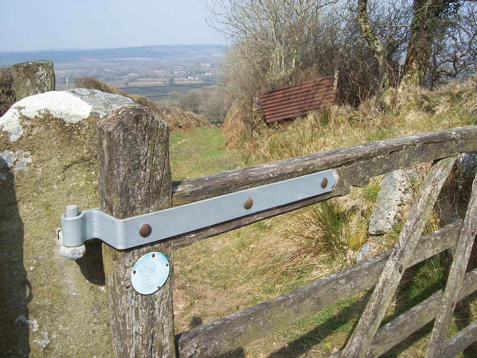
It was then an easy walk (apart from the short steep bit) back to the car.

Throughout most of the walk there were good views of the castle and from the ridge, views to the Gower peninsula.

Hopefully spring or early summer has at last arrived.

Rhandirmwyn Circular

A few post ago I wrote about this ride where it had come to an early end because of a puncture, so with a good weather forecast I saddled up again.

Route

I parked adjacent to Dolauhirion Bridge and set off. It was a bit on the chilly side with a headwind which led to me soon warming up.

Afon Tywi from Pont Newydd


I met a few patient motorists who did not try to pass until it was absolutely clear to do so – much waving with thanks.

In Rhandirmwyn there is a tempting tea shop, but as I was carrying food and drink I resisted the siren call.


I turned here to head down to the river, but stopped to take a photo of the local church and talk to two ladies who were on flower duty.  they had passed me earlier and seemed impressed with the speed I had arrived.  I said it was more to do with their slow driving!

Rhandirmwyn Church

At the river I stopped for a brew and a sandwich and then carried on to cycle nearly all down hill, passing through Cilycwm and back to the car.


Celynnog Hill (I think)


Cilycwm Church
Carmarthen Fans in the distance


Penally to Lydstep

Part of the Celtic Haven deal was the chance to receive some spa/beauty treatment.  Clearly the challenge to alter my looks would have been immense and so my wife reluctantly sacrificed a chance for a wet walk.

Route

Out came the bus pass and I caught a bus to Penally and walked back to Lydstep.  the weather was damp and misty which led to the donning of full waterproofs.  What foresight Mrs Bob has.

Penally Church

However despite the weather the coast rarely disappoints.

Tenby South Beach


Caldey Island


St Margarets


Inaccessible beach


A big hole

It was a short walk and I was soon back at base where another swim was had followed by a coffee and a read on a very comfortable settee, whilst I waited for the vision to appear.

A good break was had by all.

Lydstep Circular 2

We had visited Tenby on the Sunday morning and then back to the Celtic Haven for a Sunday lunch with all the trimmings followed by a pud.  This resulted in a short snooze but my conscious kicked in and with Mrs Bob’s permission set off for a short walk.

Route

I walked down through the Lydstep Holiday village and then east along the coast path for a while. I then cut inland using footpaths (actually on the ground) and minor roads to the north of the Celtic Haven and returned feeling a bit holier having walked at least the pud off.


Lydstep Circular 1


To celebrate my wife’s birthday I had booked a short break at the Celtic Haven between Tenby and Manorbier Pembs. The weather forecast for Saturday was looking good and a walk to Manorbier along the coast was decided on.

Route


Caldey Island


Lydstep Bay


Climbing up from the beach from Lydstep Bay we walked through a woodland thick with wild garlic.

Wild Garlic


This part of coastal path does have some steep up and downs but the promise of a cafe lunch kept Mrs Bob going.

One of the Ups


Apprentice navigator


Just as we stopped for banana break a sea mist suddenly appeared which spoiled the views although inland was fine.

The mist comes in


Nearing Manorbier we passed a zawn, a  narrow slot in the cliff and then a cromlech known as the Kings Quoit and examples of spring bursting out.


At last Manorbier


Kings Quoit
 
Turning into the bay, Manorbier castle came into view.It was closed due to a wedding taking place.

Manorbier Castle


No it’s not!


Manorbier Church


Anyway we were heading for the cafe “Beach Break” where we had a good lunch.
Suitably refreshed we headed back partly inland to avoid some but not all of the ups and downs.  Not far from Lydstep a young family were walking in front of us when we heard one of them shout that they had seen a snake!  They had indeed, an adder sunbathing just off the path.  This was a first for my wife and has now probably put the aforementioned family off country walking!

An adder


Back at the cottage we had a well deserved cup of tea and then I went for a swim – not in the sea but a swimming pool and shortly after a two course meal in the restaurant. If “The Navigator” reads this he should realise that not all walks have to be through bogs and mud sitting in a damp field drinking from a flask! He won’t change.


Brynamman Circular

The usual Sunday chat with “The Navigator” told me we were off to Brynamman to walk north onto the southern hills and moorland of the Black Mountain.

Route

We parked opposite the Black Mountain Centre but disregarded the advertised “Builders Breakfast” which consisted of 15 items for £5.95!

“The Navigator” had a leaflet which showed a walk which would form part of our overall walk and which led us down to the Afon Aman. We were well wrapped up for a winters day but along came a lady  dressed for a summers day walking three dogs.  She explained she was hot! This could have been a slapped face encounter but everyone maintained their dignity. We continued along the Aman for a while and then turned north to follow the Nant Garw river and valley.

Our mid morning break coincided with finding a convenient bench in memory of a young lad called Zac.

The steep sided valley contained a narrow path which eventually gave way to a more wider aspect.

The closeness of the road was occasionally utilized as somewhere to throw down assorted rubbish such as an office chair and a few car wheels but overall  a pleasant walk if not a bit damp in places.

We continued to follow Nant Garw and then headed up to the road near the non existent buildings shown on the map (near the “w” in Nant Garw). We crossed the road and onto the moor and around Garreg Fraith and the headed south on the path leading back to Brynamman. The path was quite boggy in places and in one place “Mrs Navigator” came close to losing a boot.  Take care if walking here after a typical Welsh winter.

Back at Brynamman we called back in the Black Mountain Centre and by luck met Alan Richards the author of “Great Walks in Carmarthenshire” and we had an interesting chat.  I have recommended his books a few times in previous blogs.

Preseli through the Back Door

“The Navigator” suggested a sneaky way up onto Mynydd Preseli from the north.

Route

We parked the car not far from the hamlet of Penygroes – parking is not easy in this area.

Towards Carn Goedog

Our route took us south west onto a permitted path, marked orange on the map. although as this is now open access presumably it no longer applies. The whole area of the Preseli can be very wet underfoot but with all the dry, cold weather we have had lately it was remarkably firm.

The morning coffee break was had by Carn Goedog and we then continued along the path and up onto the ridge between Carn Bica and Bedd Arthur and into the easterly wind. We met a party of 20 walkers who were on a break from Plymouth.

Bedd Arthur

The map shows lots of outcrops and it is fun to clamber over them with hand on rock.

Lightweight walkers only!
I daren’t add a caption

Short term memory loss now as I believe we had lunch by Carn Ddafad – las (no doubt “The Navigator” will advise!)

Our next objective was the top of Foeldrygarn and an early afternoon break.  Mrs Navigator took a tumble here when the loop at the back of her boot caught in the lace up rings in the other foot – very graceful fall, but could have been more serious.  needless to say the loops have now been cut off.

Sleeping Dragon

A direct route north took us along green lanes back to the hamlet of Penygroes and our car.

The weather started off a bit grey but brightened up throughout the day.

Brunel Trail

To celebrate the addition to my name of O.A.P. I met up with Andy who was staying in Tenby (or as his wife calls it “Paradise”) for a bike ride on the Brunel Trail, part of NCN 4. This particular section runs from Neyland to Haverfordwest and is all cycle paths.

Route

We parked the car at the slipways by Cosheston Point and then cycled over the Cleddau Bridge.

View downstream from Cleddau Bridge

There were excellent views up and down the estuary and thankfully the wind was kind.  From there we headed down through Neyland to the front on the estuary. There used to be a statue to Isambard Kingdom Brunel but some tea leaf used a crane and nicked it!

The front at Neyland


Sculpture


The plinth without Mr Brunel

We cycled through the marina, stopping for a coffee before joining the cycle path.  This is tarmac all the way. The first road traffic is met not far from Haverfordwest but even then there is a cycle track adjacent to the road.

Shared path


We had lunch in the park overlooking Haverfordwest Quay, next to the Council Offices.

Haverfordwest Quay

Suitably refreshed we set off on the return leg.  Now Andy is a lot fitter than me and when hill walking or cycling he goes on ahead and then waits for the plodder.  However today off he went at a good speed but that was the last I saw of him.

Being the tortoise in this story I saw the turning to take me off the trail and up onto the road and towards the Cleddau bridge.

The mobile went with Andy telling me that he had obviously missed the turn and was now back with Isambard by the estuary.

I cycled back to the car and Andy turned up a little later.

The day finished with a family meal back in “Paradise”

Allt y Grug

On a number of recent bike rides from Llansamlet to Ystralafera we have seen a hill which is called Mynydd Allt y Grud and I have mentioned this to “The Navigator”. Lo and behold he devised a route to take in this top

Route

We parked the car near the bike trail and read the information panel which seemed to indicate that all the footpaths are open. Don’t believe all that you read.

View of Mynydd Allt y Grug from car

It started well with early indication that all would be fine. However we soon hit problems as the first farm had a notice indicating that trespassers would be shot and survivors shot again. We met the owner and she was friendly enough. Walkers had not seen the correct path and would wander  into the farm and hence the notice. If a more  prominent sign post  was erected there would be no problems.

At the next farm on the path there was no signage. However the owner directed us to a farm track leading down to what appeared to be a quarry road.

We had hoped to take the path to Pistyll Gwyn but there was no path on the ground and so we continued on the main track leading through the wood.

At the end of the wood we spotted the track leading uphill to join the upper footpath passing the ruins of Coedcae Mawr and Tir Gawr where we stopped for lunch.We then carried on along the path to join the path leading to the top of Mynydd Allt y Grug.

View down to Pontardawe

The track from the quarry road

Upper track through wood near Coedcae Mawr
On the way up to Mynydd Allt y Grug

It seemed that this was the playground for 4×4`s and although there were excellent views it was rather scruffy.

Approaching the top

Looking to towards Varteg Hill

We continued a descent heading south west hoping to find a clear route next to the intake wall staying on the open access ground. It was not to be as it was covered in brambles.

A decision was made to trespass and head towards our earlier way up. We were spotted by the farmer who was clearly not happy with us  and we were directed back up the field to the correct path.

There were no further incidents and arrived safely back at the car after visiting Godre’r Graig Park.

Various inserts with school childrens names

A Dragon Fly
A centopede