LLangollen

My wife and I were dog sitting in Guilden Sutton near Chester and so I managed an away day with Andy. We decided to visit Llangollen.

Route

We parked near the school and walked along the canal and then onto a footpath just up from the Museum and passing above the Valle Crucis Abbey.

Llangollenn 005

Llangollenn 006

Llangollenn 007

Llangollenn 009

Llangollenn 010

We were heading towards Creigiau Eglwyseg, the limestone outcrop which is above the Dee Valley.

Llangollenn 008

At Plas yr Eglwygiau Eglwysegseg we we joined Offas Dyke and then climbed up the first valley onto the top of the limestone escarpment.

We walked east slowly descending and then climbed the hill to Castell  Dinas Bran and back to the car.

Llangollenn 011Llangollenn 013

Llangollenn 012

Llangollenn 014

Llangollenn 015


Arenig Fawr

As is usual when visiting relatives in Chester I try to have an away day with Andy my brother-in-law.

Our destination today was Arenig Fawr. The forecast for the Bala area was sunshine all day although the temperatures looked a little cool.

Route

We parked up and set off up a wide track heading for the east side of Llyn Arenig Fawr passing close to the small bothy.

101_1854

Llyn Celyn

101_1855

Arenig Fach

101_1858

Small Bothy

101_1860

Llyn Arenig Fawr

From here the path steepened towards the area shown  as Y Castell. The Viewranger track did not record the true path here as we skirted the steep rocks near spotheight 684 and then onto the ridge line leading to the summit of Arenig Fawr. We had lunch here in the shelter of a large cairn where there is a memorial plaque  sadly in need of replacement.

101_1862

Rocky approach to summit

101_1863

101_1864

The  lost crew – not sure about the stuffed animal

The summit gave outstanding views to Snowdon in the north ,Cadair Idris and the Rhinogydd in the south and the Arans to the east.

101_1861

Snowdon range

Our descent was a little off piste heading for the obvious track leading back to the minor road.

101_1865

Looking back to Arenig Fawr

The track ,very wet in places ,led past a ruined farm which looked as if it once was a sizeable holding.


101_1866

101_1867

Andy drying out a used tea bag to dispose of in a suitable bin.

We left the road near a small car park and joined the bed of a dismantled railway back to our car.


Slate Trail, Llanberis

This was forecast to be the worst day of the week for rubbish weather, they were not wrong. However there is no such thing as bad weather only inappropriate clothing. I was to find out my over trousers were inappropriate!!

The walk was almost wholly in rain either drizzle or full on but we girded our loins and went for it.

101_1549

Route

Click on links for additional information.

We parked at the road end in Dinorwig and followed signs for the Slate Trail which as described took us through the huge but abandoned slate quarries. The views down to Llyn Peris , Llyn Padarn  and the mountains beyond were partly obscured by the mist, but no doubt worth taking this route on a good day.

101_1545

Must be the wet weather.

101_1546

Llyn Padarn

101_1547

Llyn Peris

101_1548

We were also walking above the Dinorwig Power Station.

We descended down the zig zags to the southern end of Llyn Peris and then walked along the road north west to have lunch near Dolbadarn Castle.

101_1550

Dolbadarn Castle

The walk towards the country park passed  the National Slate Museum which as it had free entry in we went. There were lots of interesting photos and old machinery, clearly they were hard characters to work the mines.Click this link

101_1551

I know that face.

There are a number of colour coded walks through the wooded park and we followed the yellow path to the end of the woods and then struck uphill back to the car.

And so the end of our week in Snowdonia and considering the past weather we were pretty fortunate.


Pyg and Miners Track Snowdon

We woke to blue sky and with a favourable forecast it was time to aim higher, but not too high!

Today we would walk two of the Snowdon trails, outward by the Pyg Track and back by the Miners Track.

Route

We were at the Pen y Pas car park just after 0900 and it was already filling up. After an eye watering £10 parking fee we set off on the well engineered Pyg track.

101_1530

As we climbed the sky darkened and snow began to fall. There was a warning sign at the car park that an ice axe and crampons were required to walk to the summit of Snowdon, but we had no plan to continue beyond the junction of the Pyg and Miners tracks.

101_1531

The sun trying hard to outdo the snow.


When we reached the junction where the Crib Coch path starts the snow stopped and the views opened out. We had a quick coffee break off the path so as not to hinder the numerous walkers heading upwards.

101_1532

Llyn Llydaw


101_1533

Coffee break

The further we neared the Miners track the ground was becoming very icy and The navigator and I stopped to put on our Micro Spikes which immediately made the walk easier.

101_1535

Ice

101_1536

101_1537

The Pyg Track becoming harder

We met a volunteer Mountain Rescue team member who told us they had already been called out a couple of times that week. Even today there were people heading up into the snow without, in my humble opinion suitable footwear and clothing.

The first part of the descent down the Miners track was very slippy and Andy was extremely cautious as he did not have spikes. A number of people commented on our Micro spikes ,which are no replacement for full on crampons ,but make icy tracks easier to negotiate.

101_1538

People ascending the Miners Track from Glaslyn

Once down by the water side of Glaslyn we had lunch and then continued on the Miners Track back to base via Llyn Llydaw. This part of the track had large numbers of tourists.

101_1539

Lliwedd

101_1542

No comment necessary

101_1543

101_1544

Sky clearing

A good day out which started out in snow and finished in sunshine.


Nant Ffrancon

With strong winds forecast the higher hills would have to wait and so today we would have an elongated circular walk in Nant Francon.

Please click on any links to obtain further information.

Route

We parked in Braichmelyn just south of Bethesda near the huge Penrhyn Slate quarry. The path led steadily up through the woods onto the open hillside of Cefn Orsedd. The forecast was correct as it was certainly windy.

101_1519

A good use of doors!

101_1520

Penrhyn Slate Quarry

101_1521

Looking into Nant Francon

101_1522

101_1523

Mynydd Perfedd ridge


A suitable coffee stop was found by a sheepfold before we started the long descent to the valley floor where we crossed the Afon Ogwen. From here we walked up the minor road to reach Ogwen Snack Bar.


101_1524

101_1525

The views up the valley seem to show there is no way through but  the main road cuts through to Capel Curig. At the Snack Bar there where a lot more walkers and I can only assume they were only visiting Llyn Idwal as the weather was only for the experienced to climb further.

101_1526

Our route was back down the minor road where we left it to follow the cycle/walking route  passing the spoil tips from the slate quarry and back to the car.

101_1527

Cascades at Ogwen Bank

This was a useful recce for Andy and I as we have a plan to bike pack from Bangor up to Idwal Cottage and camp near Llyn Ogwen and perhaps on to the Capel Curig area. It seems there will be a lot of pushing the bikes!

Mynydd Mawr

Today we were heading for Mynydd Mawr where we should have good views to the east of Snowdon and  to the south of the Nantlle ridge.

Route

We parked in the village of Y Fron and walked through the old slate workings to gain access to the open countryside.

101_1499

Nantlle Ridge

101_1500

101_1503

A rare picture of The Navigator with his kit off.

101_1504

There is an obvious wide track which takes you north easterly to join the  path which gradually climbs to the summit of Mynydd Mawr. There was a sprinkling of snow towards the top.

101_1506

We looked down into Craig Cwm Du and on reaching the windy top took shelter in the summit cairn for a coffee break.

101_1505

Into Craig Cwm Ddu

There were a few walkers making their way up from Rhyd Ddu along an interesting ridge.

101_1507

Looking towards the Snowdon Range

101_1508

101_1509

Grizzled outdoor men

Just down from the summit the views of the Nantlle Valley and the ridge above the valley came into view. We walked to the edge of Craig y Bere with its steep cliffs down to the valley floor.

101_1510

101_1511

101_1512

101_1514

101_1515101_1516

101_1517

101_1518

Snowdon in the distance

A lunch spot was found as we descended to the west along the stone wall. The sun was now out and  we could have dozed off  but there was more walking to do! We continued on down and headed in the general direction  of the stone encircled Bryn Castell and on to Llyn Ffynhonnau, where again we had a break before heading back to the car.

North Wales Path and Coast

Our first full day in North Wales and today would be an inland walk, a waterfall and lastly a coast walk.

Please click on any links.

Route

We drove north towards Bangor passing the entrance to Penrhyn Castle to park at the coast near the Spinnies Nature Reserve to the east of the estuary of the Afon Ogwen.

101_1487

101_1488

We followed a lane southwards, past a local church to join the North Wales path and this took us on an easterly meandering route around to Aber Falls.

101_1489

101_1490

101_1491


Part way along we stopped for a coffee only to be joined by a large flock of sheep who wrongly assumed we would be feeding them!

101_1492

There are two waterfalls to admire the first a little smaller than the main Aber Falls but no less worth admiring. At the main fall there were a lot more visitors and the only people we had seen for the day. When we three were last here, the main falls were mainly frozen but today it was almost spring like.

101_1493

101_1494


101_1496

101_1497

We walked down the valley towards Abergwyngregin, steadfastly passing the cafe with its siren call of coffee and cake and on down to the coast. From here we followed the Wales Coast Path back to the car.

101_1498

Beware high tide.

Llyn Dinas

Our annual February trip for 2016 was to Snowdonia where we based ourselves in a nice cottage near Deinolen. Our small group consisted of “The Navigator”, Andy and myself.

As is usual we have a half day walk en route and this year we met Andy near Llyn Dinas close to Craflwyn Hall at 1300.

The weather had taken a turn for the better and it looked like we were in for at least dry conditions for a few days.

Please click on any links.

Route

We had lunch by a lovely waterfall and then headed steadily uphill to join the Watkin Path.

IMG_20160213_125532484

IMG_20160213_134345821_HDR

From here we descended to the road crossing the Afon Glaslyn to head westwards south of Llyn Dinas back to the car.

IMG_20160213_144506832

IMG_20160213_154556619

IMG_20160213_160214498

Our trip to the cottage took us through Llanberis Pass with views of the mountains surrounding Snowdon.

IMG_20160213_165240424_HDR

A good start to the week.

Northern Rhinogydd (Day 7)

Here we are on our last day and potentially the hardest. I had walked  in the Rhinogydd quite some years ago when the bigger hills of Rhinog Fawr, Rhinog Fach and Y Llethr were tackled.  My memory was of hard going – I soon found there had been no change.

Today we were heading towards Moel Ysgyfarnogod and the northern Diffwys.

Route I must add that this is not accurate once we hit the heavily shaded area!

We parked the car in a small quarry scraping east of Cefn Clawdd, the only occupied holding in this area, and then took the path leading to Wern Fach.

I say path, more like a small river. The whole area is one huge bog with lots squelching and the occasional swear word when your foothold sinks beyond the top of your gaiter. There is one signpost directing you to Cwm Bychan and the path roughly follows a wall.


As the land rose the bog became less and a coffee break was well deserved.

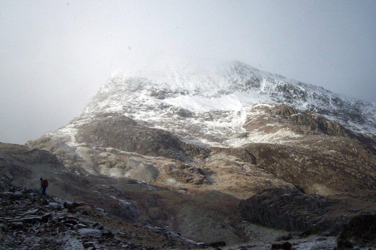
Our way up to the tops was via Bwlch Gwylim, a steep pull through snow.


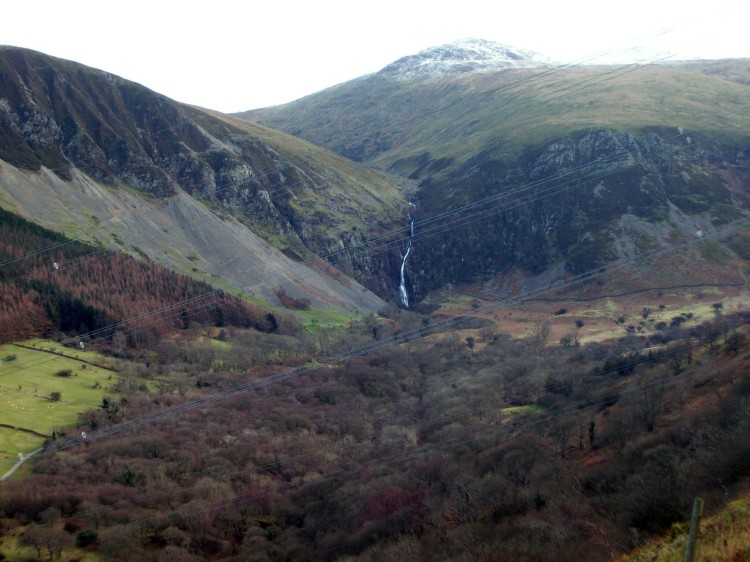
Once at the bwlch the views  opened up over to the estuary and Portmerion ( remember the series “The Prisoner?”). A lunch spot was found overlooking Llyn Corn Ystwc.


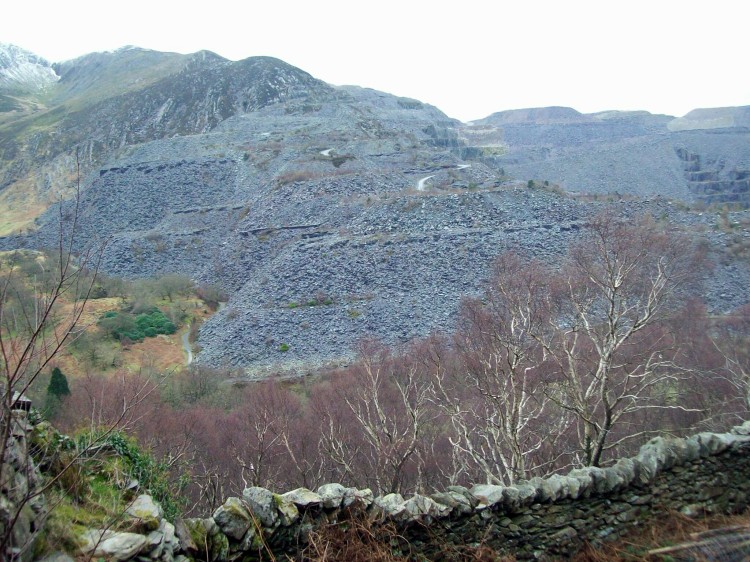
From here the route map should be taken with a pinch of salt. We were roughly heading for the ground below Moel Ysgyfarnogod and Diffwys. There was a lot of up and down, the latter involving some scrambling, not the place to be caught out in the mist – with hindsight good fun.

Having had enough “fun” we headed down to the wall and as planned found the track which led us back to Cefn Clawdd and the car.


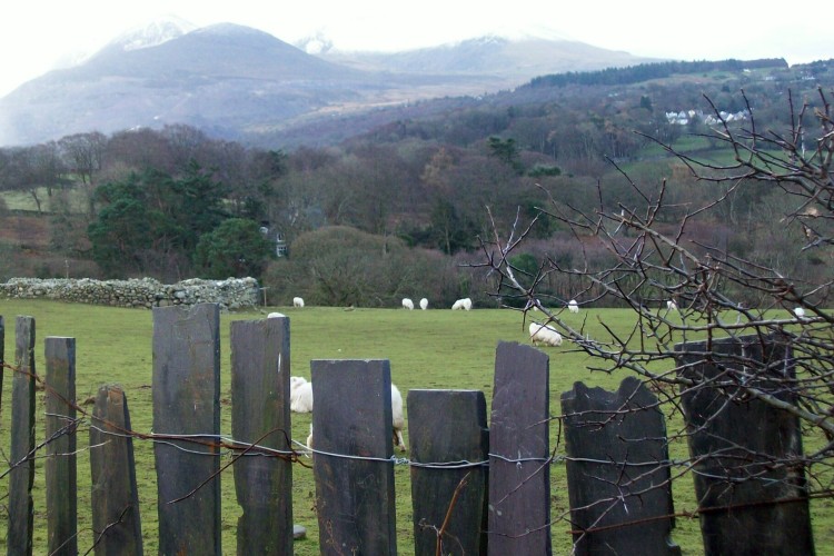
If you want the wilderness field, this the place to come.

The end of an enjoyable week.

Llyn Trawsfynydd (Day 6)

It was time for a rest day, of sorts, so a flattish walk was called for and as Llyn Trawsfynydd was close at hand, plan A was a goer.

The weather was the usual, mixed.
We walked through Trawsfynydd village, which is larger than one may expect. One famous resident was Hedd Wyn click and we passed by his home.  I understand that his nephew lives there and a guided tour can be arranged – shouldn’t take long!
We turned down to the lake and followed a good hard surface path, which is also the National Cycle Path 8, reading the occasional information board about the flora and fauna.
At the power station we were surprised to see so many cars, bearing in mind the station is now closed.  However reading more information panels, the decommissioning is on-going and will not end until 2020. Click
The path continues adjacent to woods which have the most vivid green moss I have ever seen – I assume there is no connection to the nuclear facility!
In the north west corner is the dam under which the Afon Prysor exits, it enters from the south east corner. The narrow,gorge shown as Ceunant Llennyrch looks worth exploring, but not today by two weary walkers.
From here the easy walking stops and wet moorland is met, passing Coed y Rhygen Nature Reserve. We found a lunch stop near here with good views down to the lake and beyond.
Reluctantly we set off for the last leg where we were soon back on a minor road and heading for the long footbridge which takes you back into the village of Trawsfynydd.
Hopefully tomorrow we will have a bit more fuel in our tanks as the Rhinogydd beckons.