Little Milford

No wonder the BBC wants a new weather forecasting company. The forecast for West Wales especially south of Haverfordwest was for dry weather with sunny periods. Wrong, wrong. It was raining when we left The Navigator’s house and increased in intensity by the time we arrived at the car park in Little Milford. A few hardy dog walkers left their cars but we waited for a while. However we had to don our full waterproof kit before setting off through the woodlands.

Route

101_1159

101_1160

Once through the wood we headed south east along various footpaths, passing Nash Wood and the farms of North Nash and Great Nash. We met a friendly farmer who privately probably questioned our sanity walking through rain and somewhat wet and muddy paths and even gave his permission to leave a  footpath and cross his fields. However we are made of sterner stuff and kept to the paths, which weren’t too bad.

101_1146

Our route took us east into Llangwm where we found a picnic bench overlooking the Cleddau waterway for lunch. From here we walked along the riverside path to Black Tar Point and then inland to Sprinkle Farm and on to Sprinkle Pill.

101_1150

The Cleddau Waterway is a lovely area with  lots of inlets, known as pills in this area. They have a mysterious feeling about them, with muddy creeks and the occasional houses close to the water.

101_1153101_1151

101_1149

101_1154

101_1148

Once reaching the main waterway of the western Cleddau near Underwood we walked west along a muddy foreshore passing by a derelict wooden quay.

101_1156

This whole area was mined for coal in years gone by and there was evidence of this in orange coloured streams running into the Cleddau and warnings of old mine workings.

101_1147

101_1155

Although it was still August, signs of Autumn were evident with blackberries ripening, sloes and puffballs seen.

101_1152

101_1157

The muddy track was left and we climbed uo to Hook before once again following a path down through some woods and back to the car.

St Davids

Our friends, Paul and Angela, had not walked one of our favourite stretches of the Pembrokeshire Coast Path, a circular walk from Caerfai Bay taking in Porthclais and St Davids, and on a lovely warm day an introduction was made.

Route

We were lucky to park next to the cathedral despite it being a busy day and started the walk with a coffee and cake at the tourist information centre.

From here we walked down to the coast path at Caerfai Bay and turned to walk west. A stop was had at St Non’s to visit the chapel and view the alleged health giving spring.

St Davids 004

The walk has magnificent views of cliffs and the clear blue sea. we saw people enjoying the area in kayaks, rock climbing and a group coasteering.

St Davids 008

St Davids 009

St Davids 005

St Davids 006

St Davids 007

Porthclais soon came into view and we clambered down to the harbour wall and walked along the sand to the road leading into St Davids.

St Davids 010

St Davids 011

We had hoped for lunch at the Farmers Arms, but they had just finished serving food. However we were directed to their sister pub just up the road, The Bishops. where we were refreshed with local ale and food.

Llawhaden

The Navigator’s project is nearing the end but today a visit to a supplier of stone was called for where a large quantity of Scottish cobbles was ordered. Payment made we continued on to the start of our walk.

Route

The car was parked just off the main road near Canaston Bridge and we were soon crossing fields heading to the village of Llawhaden.

IMG_20150817_114213117_HDR

IMG_20150817_114630371

IMG_20150817_114747906

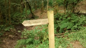
We continued on along paths and bridleways close to the Eastern Cleddau river and came across a sign for Holgan Camp.

IMG_20150817_123046664

There is a fort shown on the OS map although not named and amazingly nothing on Google about it. We headed uphill hoping to find the camp but the path was clearly not often walked and unfortunately there was no view at the top as the tree cover was dense. We returned downhill and stopped for lunch.

Refreshed we commenced our return, crossing the river and then following this south. A decision was made to follow the bridleway and not the parallel footpath. I now remembered this route from a bike ride I had some years ago where there were large stretches of flood water, but that had been winter time. It made no difference as the flood waters were still here in August!

IMG_20150817_133544387

We eventually found dry land and walked into Robeston Wathan an old bottle neck on the way west but now a quiet backwater following the building of a by pass.

IMG_20150817_132204958_HDR

IMG_20150817_135407466

We followed a rough lane under the by pass and into the wooded area of Canaston Woods which led us to Blackpool Mill now closed.

IMG_20150817_152753984_HDR

IMG_20150817_152917046

From here it was a short distance back to the car crossing again under the bypass.

Canoeing the Cleddau

My brother in law, Andy and his better half, Frances were once again spending a week in Tenby or as Frances calls it “Paradise”. To avoid the crowds and  shopping Andy and I decided to take my canoe for a paddle on the Cleddau Waterway.

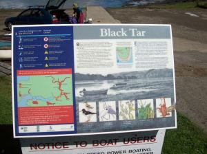
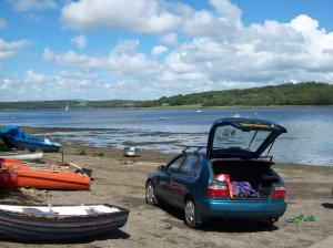
We launched from Black Tar, not far from Llangwm and headed upstream with a rising tide.

101_1137

101_1138

101_1139

The last time we paddled here we saw two foxes walking along the waterline and today we saw four, two of which may have been cubs. it is not often you see these animals in broad daylight but they seemed to be enjoying the sunshine.

101_1134

Our route took us past Landshipping and towards Haverfordwest. With the lack of current paddling time and knowing we would face a strong headwind on our return we found a suitable place for a coffee and then headed back downstream.

101_1136

We turned into the Eastern Cleddau for lunch stopping where we have previously wild camped. Across the water we saw two inflatable canoes which were making slow progress as they headed against the wind. Halfway back to Black Tar we caught up with them and later met with them at the egress. They admitted it had been hard work but the canoes did have fixed rudders which helped the boats from being blown about.

Back in Tenby we celebrated with a huge fish supper!

101_1140

Brecon

For the last few years I have travelled to Brecon with Mr &Mrs Navigator, not only for a walk but also to help erect Mrs Navigators tent. She enjoys visiting the Brecon Jazz festival and glamping – Z beds and duvets are the order here.

At short notice Mr Navigator pulled out, as a serious man illness had laid him low (since diagnosed as novovirus) and I had to take over as a route finder. A quick research of the many guide books I own found a suitable walk starting and finishing  at Talybont on Usk.
Route.

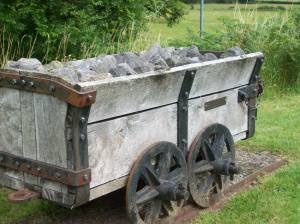
My neighbour Paul had joined us and we set off to first walk along a section of the Bryn Oer Tramroad, once linking Tredegar and Talybont. There are good views of the eastern end of the Brecon Beacons and the Talybont Reservoir as we walked up the tramway. Almost opposite the dam we turned east before joining the tow path of the Monmouth and Brecon canal which led us back to Talybont.

101_1129

101_1130

101_1128

101_1125

101_1126

101_1127

From here we drove to Brecon and the Priory Mill Farm campsite to erect the tent which went well and reasonably quick.

101_1133

101_1132

101_1131

Paul and I left Mrs Navigator to now fend for herself and we drove home.