Lake District Oct. 2017

Another October, another boys week in the Lake District with the “Navigator”, Andy and me.

Lakes 2017 155

Bob

Lakes 2017 099

The Navigator and Andy

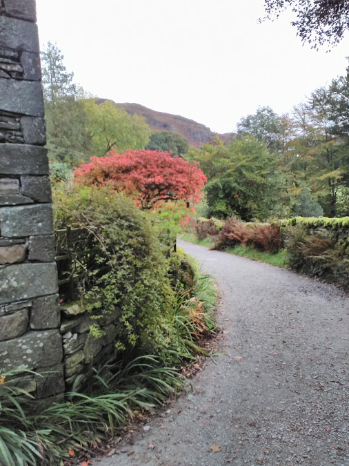
The “Navigator” and I set off from West Wales to meet up with Andy in Chester and then on to Cumbria. We left the M6 at Shap taking minor roads to the east of Bampton Grange and parked up by spot height 257 and started to walk up a farm track at Scarside.

Route

From there we walked below the woodlands and then on to the limestone pavement. Fungi was in abundance especially of the waxcap group. More of those were seen throughout the week.

Lakes 2017 088

Lakes 2017 089

Lakes 2017 090

Lakes 2017 116

Lakes 2017 169

Lakes 2017 091

Lakes 2017 092

Limestone pavement

This was a short walk to stretch the legs after a long car ride and we weren’t far from our cottage at Helton. This apparently is the oldest building in the village.

Lakes 2017 171

Sunday 15/10/17

This could be described as a two centre walk or a figure of eight walk with lunch in between.

 Route 1

Route 2

Our morning walk was along  Swindale soon leaving the metalled road and onto rough ground first between stone walls and then on to open ground. The beck was straightened in the past to gain more land but the bends have now been reinstated.

Lakes 2017 093

Lakes 2017 095

Lakes 2017 094

Lakes 2017 096

Lakes 2017 097

We crossed to the beck and gradually climbed to view a number of waterfalls which were in  a good flow. At the top we returned to the car via the bridle path shown on the OS map.

Lakes 2017 098


Lakes 2017 100

Lakes 2017 101

Lakes 2017 102

Om our way back we passed a group with five  border collies which is frankly greedy especially as I just want one!

Lakes 2017 103

Three of the five collies

Back at the car we had lunch and decided to continue walking over to view  the Naddle Valley where we walked through Naddle farm now a base for the RSPB. It was hoped we could make a circuit by crossing the Haweswater Dam but there is no path to cross this feature. Instead we walked back to Naddle bridge and returned to the car along the water board road and the then the public road along Swindale.

Lakes 2017 105

Haweswater dam

Lakes 2017 106

The old and not so old Naddle Bridge

Lakes 2017 107

Monday 16/10/17

This was the week including the storms of Ophelia and Brian and the winds today indicated care should be taken if any height gained. We parked in Pooley Bridge in a side street as the official parking was far too expensive and walked down through the village and onto the lake side of Ullswater.

Lakes 2017 108

A misty morning

Lakes 2017 109

A ferry under repair

Route

With all the rain of recent and current days it was very wet underfoot especially across fields. The route zig zagged up to Arthurs Pike which gave good views of Ullswater and down to Glenridding.

Lakes 2017 110

Lakes 2017 111

Lakes 2017 112

Lunch on the way to Arthur’s Pike

Lakes 2017 113

Looking down on to Ullswater

Lakes 2017 114

The cairn at Arthur’s Pike


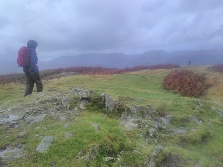
The wind was strong and we had to hold on to the cairn for safety and the return back to Pooley Bridge was away from any edges.

Lakes 2017 115


That night a tree came down in the garden and a partial collapse of a stone wall!

Lakes 2017 118

Storm damage.

Tuesday 17/10/17

The forecast was not looking good and so a low level walk was decided on. The route was from Pooley Bridge to Aira Force with a bus trip back to the car.

Route

Lakes 2017 119

Crossing a muddy field near Bennethead

It was very wet and muddy throughout and there was evidence of the strong winds as we walked through a wooded area.

Lakes 2017 120

It would be useful if a similar sign was at the other end as well!

Our route took us around Gobarrow Fell which on a better day would have given fine views of Ullswater and the surrounding hills.

Lakes 2017 121


Lakes 2017 123


Lakes 2017 124

The waterfalls at Aira Force were magnificent with lots of visitors taking in the views.

Lakes 2017 127

Looking down onto Aira Force

Lakes 2017 126

Lakes 2017 128

Aira Force

Lakes 2017 129

Lakes 2017 130

A big tree!


Since I last visited here the National Trust have a new visitor centre and a welcome cafe where we stopped for some refreshment whilst waiting for the bus. Unfortunately our Welsh bus passes are not valid here and we had to buy the very expensive tickets.

Wednesday 18/10/17

The forecast was looking much better with clear sky and little wind and so we were heading a little higher, with Andy going higher again.

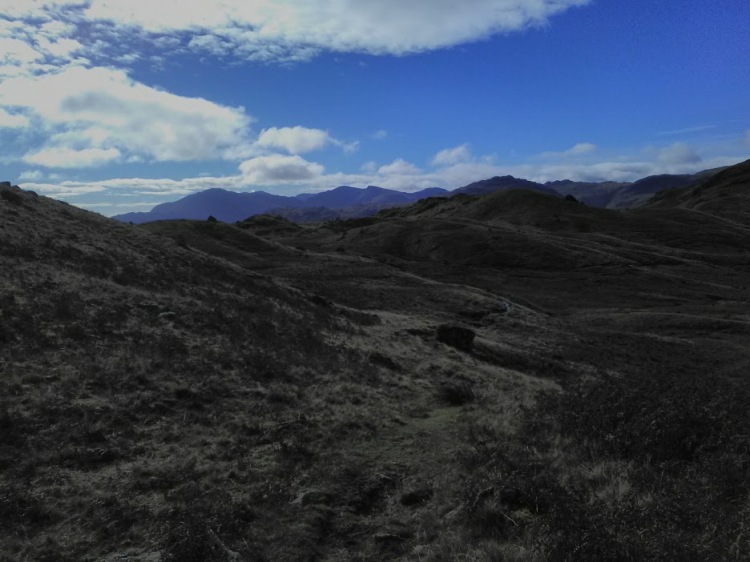
We drove to the south end of Haweswater to walk up the ridge overlooking Riggingdale. It was in this area that England had its only golden eagles but the last one was seen in 2015.

Lakes 2017 131

Route

The first part of the walk is alongside the lake to The Rigg and then its up, up and away with hands on rock in some places.

Lakes 2017 132

The way around to The Rigg

Lakes 2017 134

Riggingdale

Lakes 2017 135

Haweswater

Lakes 2017 137

Lakes 2017 140

Lakes 2017 139

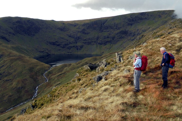
Blea Water with High Street above

The weather had brought out more walkers than we had met since Saturday including a couple from Belgium with a husky or malamute attached to the man with a harness and a long lead. This did look somewhat dangerous when they reached a steep section of the climb but they made it. There was one hilarious interval when they reached the flat boggy area of Caspel Gate when Olaf the dog tried to jump across a gap but belly flopped into the sticky mud. It would have been funnier if the owner had been pulled in!

We had lunch here and the “Navigator” and myself decided not to continue up to High Street but young Andy still full of puff continued on up and we would meet up again at the car. Our way down was via Blea Water and Blea Water Beck where again the waterfalls were in full flow. Underfoot the paths were sodden.

Lakes 2017 141

Blea Water

Lakes 2017 142

Blea Water Beck

Lakes 2017 143

Waterfall on the Blea Water Beck

We had thought that Andy would come down the Nan Bield Pass but he  retraced his steps down the way we went up.

Lakes 2017 144

Ye olde sat. nav.

Thursday 19/10/17

Our destination today was Howtown and Martindale and the surrounding hills.

Route (there is a small part missing towards the end)

We walked  anti clockwise around Hallin Fell and then alongside the lakeside path to the foot of Scalehow Beck.

Lakes 2017 146

The Coombs

Lakes 2017 147

The way down to Howtown

Lakes 2017 150

Lakes 2017 148

Looks like fun


From here we headed uphill  and eventually onto Birk Fell. Martindale is known for its deer herds and we could hear the bellowing of the stags and in the distance we could see the hinds and a couple of stags.

Lakes 2017 151

Climbing up near the beck

Lakes 2017 154

Looking down towards Glenridding

Lakes 2017 153

Lakes 2017 155

Bob

Our way back was between the gap between The Knight and High Dodd. The former, when viewed from one side is similar to our Welsh Cnicht.

Lakes 2017 152

The Knight

Lakes 2017 156

Discarded antlers

Lakes 2017 157

Lakes 2017 159

A signpost by Royal Appointment?

Lakes 2017 158

A bridge too far.

Friday 20/10/17

The week has flown and today is our last walking day and not too far from base.

Route

We parked in the hamlet of Burnbanks which was built for those involved with the Haweswater reservoir.

Lakes 2017 160

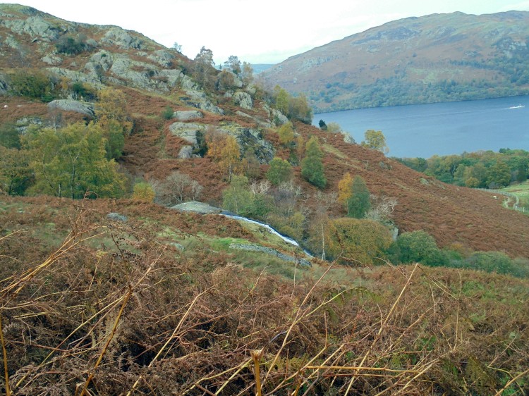
We walked on the north shore away from the dam until we reached Measand beck and its waterfalls.

Lakes 2017 161

These signs are much better than the modern wooden type.

Lakes 2017 162

Looking down Haweswater

Lakes 2017 165

Coffee break

Lakes 2017 166

More waterfalls

Lakes 2017 164

Even more

Lakes 2017 167

Lakes 2017 168

Crop circles?

From here we struck uphill and onto Bampton Common. We lunch near Ulgill Gutter  and then towards Broom Bank crossing Howes beck near the dam. We had a coffee break in the Howes and then on into Bampton and followed the lane back to the car.

Lakes 2017 170

Juust so Andy’s wife can see he can handle a vacumn cleaner!


SkelwithBridge, Ambleside, Rydal, Loughrigg Fell

Our last day walking in the Lake District and the weather is still behaving.

Today we started from base gradually circling to Ambleside (no gear shopping), Rydal Water, up to the trig point on Loughrigg Fell and dropping back to our HQ.

Route

We headed east passing under Ivy Crag to Todd Crag and passing Lily Tarn. From here we followed a path leading steeply down to Ambleside.

fri-1

fri-3

Windermere

fri-4

fri-5

Lily Tarn


There was a short stretch of busy road walking before we cut off to a path which took us to Rydal MountRydal Mount with views of Rydal Water and Loughrigg Fell. A brave soul was spotted swimming in the lake whilst we tucked in to lunch.

fri-6

Gardens in Rydal Mount

fri-7

Rydal Water and Loughrigg

fri-8

We crossed over to the south side of the lake and came across a huge cave the result of quarrying in the past.

fri-9

fri-11

The collar work now started as the route climbed to the summit of Loughrigg Fell before the steep descent back to base.

fri-12

That way.

Once again a good week of walking and although we had some rain mostly it was dry and despite it being October winter woollies were not required.

Thanks to our better halves for letting us out to play.

fri-13

That’s all Folks


Tarn Hows Circular

Another rain free day and we set off to park at Glen Mary.

thurs-13

Route

We set off up the small gorge which contains Tom Gill and leads up through woodlands to Tarn Hows and I agree with the “Navigator” this is the best approach to this honey pot.

thurs

Tom Gill

thurs-2

Further up the Gill

thurs-3

Andy admiring the waterfall

From here we walked alongside the Tarn and then struck up for Black Crag.

thurs-4

Tarn Hows

thurs-5

Coffee break view of Tarn Hows

thurs-6

A distant view of Langdale Pikes

thurs-7

Subsidiary summit of Black Crag

thurs-8

A little further on at Park Fell we turned south west heading for Yew Tree Tarn and Harry Guards Wood and the car.

thurs-9

Looking down to Elterwater

thurs-10

Bracket Fungi

thurs-11

Reflections in Yew Tree Tarn

thurs-12

The Tarn is part of a 4000 acre estate

Langdale Linear

Weather was now improving and we ventured a little higher. Today would entail a bus ride from Skelwith Bridge to the New Dungeon Gyhll pub and then ascend to Stickle Tarn and wend our way back to Skelwith roughly following the easterly ridge.

Route

Our Welsh bus passes unfortunately are invalid in England and Andy a “Sais” was too young for a pass. The single fare was £4.80!!! At the pub we soon started the climb alongside the river leading to Stickle Tarn.

wed-1

wed-2

The climb to Stickle Tarn

The path is engineered all the way and there seemed to be a continuous line of people all heading up. The old path on the left is clearly no longer encouraged although our young Andy way out in front of us took it. We eventually met up at the tarn and the crowds expected had dispersed.

wed-3

Andy walking on water

wed-5

Stickle Tarn with Harrison Stickle in background

The cliff face opposite the tarn is Pavey Ark with the infamous Jack’s Rake.

wed-4

Pavey Ark

We were not going that way and our route went south easterly up and down various outcrops leading back to Skelwith Bridge.

wed-6

wed-7

Easedale Tarn

wed-8

Coledale Tarn

wed-9

Lunch stop

wed-10

Great Langdale

wed-11

Grasmere and Rydal Water

wed-12

wed-13


The views today were extensive and clear.


Windermere and Latterbarrow

Tuesday was forecast to be the wettest day and so a fairly low level walk was called for, no point in having expensive rain proof gear if not used!

The “Navigator”had to amend his original plan as parking in this area is hard to find. However we found a  village hall in Far Sawrey with an honesty box where we did pay the suggested fee of £2.00 a bargain in the Lakes.

Route

It started out dry but we soon donned the gore tex and headed down to the lakeside for a cup of coffee.

tues

A calm Windermere

tues-2

Shaggy ink cap?

tues-7

Fly agaric

There lots of other nutters out for a walk.

At Belle Grange we took the path signposted for Hawkshead a steep and slippery ascent. Our objective was Latterbarrow but this was to be tackled after a very wet lunch stop.

Our route to the hill could have been better as we battled our way through the mess left when trees have been felled.However we found the right track and were rewarded with good views from the summit.

tues-6

Monument on Latterbarrow

V

tues-4

Views opening up


tues-5

tues-3

From here we walked south passing a number of tarns until we arrived back at the car.

tues-8

Tarns on way back

A warning here if you are considering visiting Hawkshead with the hope of finding food supplies, DON’T. It’s full of shops all trying to extract the tourist pound.

Food was found in Ambleside.

Swirl How

The forecast was not the best but the decision was to visit Swirl How via Little Carrs, Great Carrs, Swirl How and then Grey Friars.

Route

At our age we use the car to gain height and so the old Toyota wheezed its way up the Wrynose Pass with sections of 25% incline until we parked not far from The Three Shire Stones.

We dressed in full wet weather gear as it was raining and a stiff breeze blowing. The tops were cloud covered but we  are eternal optimists!

The path up has been engineered for a good section of the route and made for easy walking.

monday-5

A look back from our route up

There  were  occasional views down Tilberthwaite but the wind kept us from wandering too near the edges.

monday-2

monday-3

Cloudy and moody

At Great Carrs there was a memorial to a second world war plane crash which made for sad reading. Two of the Canadian training crew were only 19.

monday-1

Sad remains


There were more gaps in the cloud when we reached the summit of Swirl How and we had a lunch break in a sheltered  spot. My camera died here.

Grey Friars was our next objective before  the downward route back to the car.


monday-4

Heading back to the blue dot on the road.


Skelwith, Tilberthwaite, Little Langdale

Day 2 of our tour was supposed to be flat day but overall we climbed 2300 plus feet!

We started from base and our first objectives were Skelwith Force and then Colwith Force before heading south west to High Tilberthwaite. From here we headed north into Little Langdale and back to base via Elterwater.

Route

In Tilberthwaite we came across a school party who were being instructed in the art of ghyll scrambling. Andy and I suggested to the “Navigator” that instruction on outdoors skills should form part of each trip. We may have to wait a long time!

lake-sun-1

View from cottage

lake-sun-2

Skelwith Force

lake-sun-3

Colwith Force

lake-sun-4

Typical Cumbrian Farm

lake-sun-5

For the woodpile admirers

lake-sun-6

In need of TLC

lake-sun-7

Hodge Quarry

lake-sun-8

Herdwick

lake-sun-9

Keeping an eye out

lake-sun-11

View down Tilberthwaite

lake-sun-12

On holiday from Scotland

lake-sun-13

Old bridge over River Brathay

lake-sun-14

lake-sun-15

Little Langdale Tarn

lake-sun-16

Looking toward Langdale Pikes from Elterwater

lake-sun-17

Loughrigg Tarn

lake-sun-18

lake-sun-19

Last hill of the “flat” day


Lake District 10/2016- Staveley

This was day one of “the boys” week away in the lake District, Cumbria. We were based near Skelwith Bridge.

The “Navigator” and I travelled to Chester to pick up Andy and then onto the lake District. As usual we stopped for a short walk on the way to our base and the stop this time was in the village of Staveley.

Route

The weather was good and we were soon down to shirt sleeves. The floods of earlier this year were still in evidence as  there was a bridge closed in the village and another bridge washed away on our planned route.

stavely-1

Staveley

stavely-2

stavely-3

Navigators first ascent of the week

stavely-4

large fungi at base of oak tree

stavely-7

stavely-6

Potters Tarn

stavely-8

Where’s the bridge?


Lake District

Every October The Navigator and I spend a week in the Lake District. We were joined this time by my recently retired brother-in-law, Andy. Our base was in Lorton Vale which gave us access to the north western hills.

A map of the area with indications of our routes is below.

101_1328

The weather leading up to our trip (10th to 17th) had been dry for some time, would it last? In fact it went on and on and our waterproofs were of use only to keep the chill wind at bay.

After picking Andy up in Chester we headed north up the M6 with no traffic hold ups. Our usual practice of having a short walk on the route north continued and we turned off at junction 36 with an objective to climb the limestone outcrop of Holmepark Fell. The limited parking near Holme Park Farm where we had planned to take the marked path was full and so we nearly gave it up as a bad job. However as we returned a parking spot was found by Dykes Bridge and another path by Townend Farm. A close look at the map shows a crowded area of contours and our route went straight up a scree/mud path, an unwelcome climb after a long drive. However with suitable stops to admire the views we made it to the top and the limestone pavement. Our route down was a lot more forgiving and we continued of our journey to Lorton Vale and our cottage at The Hope Farm, an apt name for guys of our age!

101_1265

101_1262

101_1263

101_1264

Sunday soon arrived and from our cottage we could see Scotland in the distance with good weather forecast. Our objective today was Mellbreak. A fell which seems to stand on its own, with a steep up, a walk across the top and a steep down.

Mellbreak

Mellbreak


101_1267

Views on climb

Views on climb


Are we going up there?

Are we going up there?


101_1270

Crummock Water and Buttermere

Crummock Water and Buttermere


North Summit

North Summit


Crummock Water & Buttermere

Crummock Water & Buttermere from the south summit.

On our way down we visited Scale Force, which was lacking force due to very little rainfall.


Scale Force

Scale Force


Scale Force

Scale Force

We walked back to the car, alongside the edge of Crummock Water.


Lonely kayakers

Lonely kayakers


Light failing on Crummock Water

Light failing on Crummock Water

On Monday Scotland was once again in view and this was going to be our benchmark for good weather and to avoid boring my reader it was like this until Friday! Today we were tasked with climbing Barf and Lords Seat and my quick look at the map indicated a short day, it was not to be!

We parked opposite the Swan Hotel and soon a footpath sign showed the way to Barf. We should have paid more attention to the route shown in Mr Wainwrights guide. The lower slopes of the hill are well known for two rocks painted white, known as the Clerk and The Bishop.

The white Bishop

The white Bishop

We were somewhat misled as we began to follow an obvious path which led to these outcrops. It went up steeply on scree and we turned away but it was still  a knee touching chin climb.

101_1280

A small ledge was found to have a coffee. Obviously by now we recognised we had taken a more “interesting” route up the fell and continued upwards until we were met with a rock face.

Towards Derwent Water

Towards Derwent Water

Bassenthwaite Lake

Bassenthwaite Lake

There was much chin stroking and false attempts at a way through but in the end we had to take off our rucksacks to enable a climb through a gap in the rock and then by judicious use of a spare bootlace lift the sacks up to safety.

The awkward step

The awkward step

From here the route became much easier and we were soon on the top of Barf and headed over to Lords Seat before descending through the forest back to the car.

101_1285

101_1286

Towards Lords Seat

Towards Lords Seat


Summit Lords Seat

Summit Lords Seat


Looking back to Barf

Looking back to Barf


Just for me

Just for me


Towards Siddaw

Towards Skiddaw


Good crop of fungi

Good crop of fungi

Tuesday was to be an away day and we headed over to Ennerdale Water, a fairly quiet part of the Lake District. We were heading to Anglers Crag and Crag Fell again trusting in Mr Wainwrights guidance to a gently climbing path which we  ignored (missed).

101_1294

Our destination


Ennerdale Water

Ennerdale Water

101_1298

Good progress was made on the lakeside path until we realised the diagonal rising path we were looking for had not been seen (we did see it on the way back!). With yesterdays climbing experience fresh in our minds we struck upwards battling through bracken and whatnot until we made the top of Anglers Crag for a welcome coffee.

Anglers Crag

Anglers Crag

From here we were now on more obvious ground and continued to climb on good paths to the top of Crag Fell where we settled down for lunch.

101_1300

Path to Crag Fell


Looking down to Ennerdale Water

Looking down to Ennerdale Water


Towards Pillar

Towards Pillar


Towards Red Pike

Towards Red Pike

We could have returned downhill by a good and obvious path, but no, we took another “interesting route” which went over boggy ground and more bracken bashing, down to the lakeside and returned us to our car.

We woke to another good day on Wednesday although there was a chill in the air. Our target today was Grisedale Pike and Hobcarton Crag a sort of horseshoe. No doubt today we would have to pay for parking in one of Whinlatter Forest’s car parks, but no, the meter was covered up, result.

101_1312

It was a steady pull up to the summit of Grisedale but the views were well worth it.


101_1305

Ridge to Hopegill End

Ridge to Hopegill End


View from Grisedale

View from Grisedale


Another view

Another view


Lunch

Lunch


101_1311

The Navigator and I realised that there would be an early finish today and so we gave the youngster the chance to extend his walk to take in Hopegill Head and Whiteside which he of course did whilst us old ones had a leisurely lunch and a stroll down Hobcarton Crag back into the forest and the car. I even had time for a visit to the fleshpots of Keswick before Andy came home.

The week is flying by and here we are at Thursday already, with our venue Carling Knotts and Blake Fell near the shores of Loweswater.

101_1313


Carling Knotts

Carling Knotts

View down to Loweswater

View down to Loweswater

The climb up to Carling Knotts went well, perhaps hill fitness is happening.

Me

Me

We had lunch overlooking Cogra Moss before returning towards Holme Wood.

Cogra Moss

Cogra Moss

It was here we gave Andy another chance to extend his walk straight down through the woods, across the valley floor and up towards Low Fell where The Navigator explained there would be a good view down to Buttermere. The B Team strolled down a wide green path to High Nook farm and back to the car near Watergate Farm to await Andy.

101_1318

101_1319

101_1320

The hill Andy was heading for

There had been some confusion here as time was getting on and no sign of Andy. After a couple of walks up the lane to obtain a signal my mobile rang with Andy telling me he was in Thackwaite Village! We eventually met up without the need to call out the mountain rescue team.

Friday morning was the only day we could not see Scotland and the day was overcast all day. We were off to climb to  Greystones and Broom Head.

A diversion was planned to look at Spout Force which like the previous waterfall we had seen earlier in the week there was little water.

101_1321

Spout Force

From here we cut through the woods of Darling How Plantation to meet the path halfway up to Greystones. From here we headed on to Broom Fell from where we could see most of the tops we had climbed throughout the week.

101_1322

Towards Broom Fell


Greystones summit

Greystones summit


Cairn on Broom Fell

Cairn on Broom Fell

Start of descent

Start of descent

Following lunch we headed down through the valley to the car. Although we knew this would be an early finish we did not extend Andy,s day and he stayed with us whilst we paid a visit to the Whinlatter Centre and were astounded at the cost of some of the mountain bikes on sale.

Sculpture at Whinlatter Centre

Sculpture at Whinlatter Centre


Fungi

Fungi

This was without doubt the best week of weather we have experienced in the Lakes in October and if this is global warming, bring it on!


Whitbarrow

More rain and even lower cloud but we were not deterred. Today’s destination was the limestone escarpment of Whitbarrow.

Route

We parked by Millside and started up through the woods climbing into the rain and mist. I am sure there are good views from up here but you will have to “google”them.


At least one view as we climbed


It says it all


Nice summit cairn

Following lunch the mist cleared a little as we descended steeply through more woods to the valley floor passing Witherslack Hall.

Keep the home fired burning


Apparently we were up there


Lovely welcoming sign

We also passed an interesting art gallery before coming out at Beck Head where it seemed a stream came from under a limestone outcrop and some very nice private homes.

Beck Head

It was still raining.

Back to base for our last meal and packing up for the  trip home on Friday.

Although we could have done with better weather I still enjoyed the walks and countryside we saw in this part of the Lakes.