Newgale

The 31 October and here we are walking in shirtsleeves. Today’s venue was a circular walk based on Newgale,  Pembrokeshire.

Route

I was surprised to see a reasonable surf breaking with a couple of surfer dudes out enjoying themselves. With the tide ebbing we walked onto the beach  to Pwll March and then cut up along a rather overgrown path to Pen Y Cwm.

newgale-022

North Newgale Beach

newgale-023

newgale-024

newgale-025

We turned up a road past some houses and continued along a path which the further we went the wetter it became until we hit a minor road.

newgale-034

Where did I leave that tractor?

newgale-038

newgale-039

newgale-046


Here we turned south until the village of Roch was reached and where we had lunch in the village play area.

newgale-057

Suitably rested we continued on tarmac in a south westerly direction until we came to the coast at Nolton Haven and then north following the coast path back to Newgale.
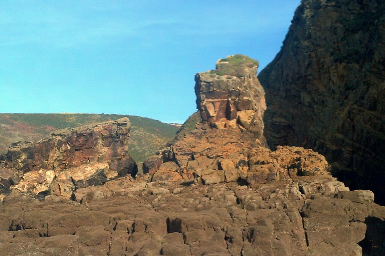
newgale-079

Nolton Haven

newgale-080

newgale-081

A chimney which is all that remains of a coal mine

newgale-082

Whilst in Roch I received a very curt text from my wife who was clearly not best pleased that I had treated myself to a slice of home made Christmas cake which she was keeping for a good friend. A similar incident took place a few years ago. I can report that the cake was delicious.

newgale-088

SkelwithBridge, Ambleside, Rydal, Loughrigg Fell

Our last day walking in the Lake District and the weather is still behaving.

Today we started from base gradually circling to Ambleside (no gear shopping), Rydal Water, up to the trig point on Loughrigg Fell and dropping back to our HQ.

Route

We headed east passing under Ivy Crag to Todd Crag and passing Lily Tarn. From here we followed a path leading steeply down to Ambleside.

fri-1

fri-3

Windermere

fri-4

fri-5

Lily Tarn


There was a short stretch of busy road walking before we cut off to a path which took us to Rydal MountRydal Mount with views of Rydal Water and Loughrigg Fell. A brave soul was spotted swimming in the lake whilst we tucked in to lunch.

fri-6

Gardens in Rydal Mount

fri-7

Rydal Water and Loughrigg

fri-8

We crossed over to the south side of the lake and came across a huge cave the result of quarrying in the past.

fri-9

fri-11

The collar work now started as the route climbed to the summit of Loughrigg Fell before the steep descent back to base.

fri-12

That way.

Once again a good week of walking and although we had some rain mostly it was dry and despite it being October winter woollies were not required.

Thanks to our better halves for letting us out to play.

fri-13

That’s all Folks


Tarn Hows Circular

Another rain free day and we set off to park at Glen Mary.

thurs-13

Route

We set off up the small gorge which contains Tom Gill and leads up through woodlands to Tarn Hows and I agree with the “Navigator” this is the best approach to this honey pot.

thurs

Tom Gill

thurs-2

Further up the Gill

thurs-3

Andy admiring the waterfall

From here we walked alongside the Tarn and then struck up for Black Crag.

thurs-4

Tarn Hows

thurs-5

Coffee break view of Tarn Hows

thurs-6

A distant view of Langdale Pikes

thurs-7

Subsidiary summit of Black Crag

thurs-8

A little further on at Park Fell we turned south west heading for Yew Tree Tarn and Harry Guards Wood and the car.

thurs-9

Looking down to Elterwater

thurs-10

Bracket Fungi

thurs-11

Reflections in Yew Tree Tarn

thurs-12

The Tarn is part of a 4000 acre estate

Langdale Linear

Weather was now improving and we ventured a little higher. Today would entail a bus ride from Skelwith Bridge to the New Dungeon Gyhll pub and then ascend to Stickle Tarn and wend our way back to Skelwith roughly following the easterly ridge.

Route

Our Welsh bus passes unfortunately are invalid in England and Andy a “Sais” was too young for a pass. The single fare was £4.80!!! At the pub we soon started the climb alongside the river leading to Stickle Tarn.

wed-1

wed-2

The climb to Stickle Tarn

The path is engineered all the way and there seemed to be a continuous line of people all heading up. The old path on the left is clearly no longer encouraged although our young Andy way out in front of us took it. We eventually met up at the tarn and the crowds expected had dispersed.

wed-3

Andy walking on water

wed-5

Stickle Tarn with Harrison Stickle in background

The cliff face opposite the tarn is Pavey Ark with the infamous Jack’s Rake.

wed-4

Pavey Ark

We were not going that way and our route went south easterly up and down various outcrops leading back to Skelwith Bridge.

wed-6

wed-7

Easedale Tarn

wed-8

Coledale Tarn

wed-9

Lunch stop

wed-10

Great Langdale

wed-11

Grasmere and Rydal Water

wed-12

wed-13


The views today were extensive and clear.


Windermere and Latterbarrow

Tuesday was forecast to be the wettest day and so a fairly low level walk was called for, no point in having expensive rain proof gear if not used!

The “Navigator”had to amend his original plan as parking in this area is hard to find. However we found a  village hall in Far Sawrey with an honesty box where we did pay the suggested fee of £2.00 a bargain in the Lakes.

Route

It started out dry but we soon donned the gore tex and headed down to the lakeside for a cup of coffee.

tues

A calm Windermere

tues-2

Shaggy ink cap?

tues-7

Fly agaric

There lots of other nutters out for a walk.

At Belle Grange we took the path signposted for Hawkshead a steep and slippery ascent. Our objective was Latterbarrow but this was to be tackled after a very wet lunch stop.

Our route to the hill could have been better as we battled our way through the mess left when trees have been felled.However we found the right track and were rewarded with good views from the summit.

tues-6

Monument on Latterbarrow

V

tues-4

Views opening up


tues-5

tues-3

From here we walked south passing a number of tarns until we arrived back at the car.

tues-8

Tarns on way back

A warning here if you are considering visiting Hawkshead with the hope of finding food supplies, DON’T. It’s full of shops all trying to extract the tourist pound.

Food was found in Ambleside.

Swirl How

The forecast was not the best but the decision was to visit Swirl How via Little Carrs, Great Carrs, Swirl How and then Grey Friars.

Route

At our age we use the car to gain height and so the old Toyota wheezed its way up the Wrynose Pass with sections of 25% incline until we parked not far from The Three Shire Stones.

We dressed in full wet weather gear as it was raining and a stiff breeze blowing. The tops were cloud covered but we  are eternal optimists!

The path up has been engineered for a good section of the route and made for easy walking.

monday-5

A look back from our route up

There  were  occasional views down Tilberthwaite but the wind kept us from wandering too near the edges.

monday-2

monday-3

Cloudy and moody

At Great Carrs there was a memorial to a second world war plane crash which made for sad reading. Two of the Canadian training crew were only 19.

monday-1

Sad remains


There were more gaps in the cloud when we reached the summit of Swirl How and we had a lunch break in a sheltered  spot. My camera died here.

Grey Friars was our next objective before  the downward route back to the car.


monday-4

Heading back to the blue dot on the road.


Skelwith, Tilberthwaite, Little Langdale

Day 2 of our tour was supposed to be flat day but overall we climbed 2300 plus feet!

We started from base and our first objectives were Skelwith Force and then Colwith Force before heading south west to High Tilberthwaite. From here we headed north into Little Langdale and back to base via Elterwater.

Route

In Tilberthwaite we came across a school party who were being instructed in the art of ghyll scrambling. Andy and I suggested to the “Navigator” that instruction on outdoors skills should form part of each trip. We may have to wait a long time!

lake-sun-1

View from cottage

lake-sun-2

Skelwith Force

lake-sun-3

Colwith Force

lake-sun-4

Typical Cumbrian Farm

lake-sun-5

For the woodpile admirers

lake-sun-6

In need of TLC

lake-sun-7

Hodge Quarry

lake-sun-8

Herdwick

lake-sun-9

Keeping an eye out

lake-sun-11

View down Tilberthwaite

lake-sun-12

On holiday from Scotland

lake-sun-13

Old bridge over River Brathay

lake-sun-14

lake-sun-15

Little Langdale Tarn

lake-sun-16

Looking toward Langdale Pikes from Elterwater

lake-sun-17

Loughrigg Tarn

lake-sun-18

lake-sun-19

Last hill of the “flat” day


Lake District 10/2016- Staveley

This was day one of “the boys” week away in the lake District, Cumbria. We were based near Skelwith Bridge.

The “Navigator” and I travelled to Chester to pick up Andy and then onto the lake District. As usual we stopped for a short walk on the way to our base and the stop this time was in the village of Staveley.

Route

The weather was good and we were soon down to shirt sleeves. The floods of earlier this year were still in evidence as  there was a bridge closed in the village and another bridge washed away on our planned route.

stavely-1

Staveley

stavely-2

stavely-3

Navigators first ascent of the week

stavely-4

large fungi at base of oak tree

stavely-7

stavely-6

Potters Tarn

stavely-8

Where’s the bridge?


Stacpole

As “The Navigator” had to visit a shed maker in near Pembroke the proposed walk was also to be in Pembrokeshire near Stacpole.

RouteRoute

We parked in a small car park in  Castle Dock Wood  and set off uphill on a minor road and had a coffee break in the churchyard of St Twynnells.

101_2116

101_2117

The tower of St Twynnells

From there we continued westwards hoping to cut south down to the coast at Stack Rocks but it became obvious from the explosions that Castlemartin range was in full use and as we approached the range we could see moving tanks in the distance.

101_2118

101_2119

At the viewing area there was a leaflet about a dedicated path which skirts the range, with  worrying markers in the shape of a tank!

101_2120

A German Tank

Our route was now south easterly into the village of Bosherton. We came across a worked out quarry where we had an afternoon cuppa. I was sure that I had taught canoeing in the lake here but today there was little water.

101_2121

From the village of Bosherton we headed north along side the Lily Ponds back to the car.

101_2122

101_2123

Bosherton Church

As we walked along there were a number of sightings of herons who seemed to take little interest in us.

101_2124

101_2125

101_2126

101_2127

101_2128