Usk Reservoir

A gentle walk today around Usk Reservoir.

Usk Resr 009

Throughout the walk there were good views of the Carmarthen Fans (The Black Mountain) and of course of the reservoir itself.

Usk Resr 002

Usk Resr 004

Route

Usk Resr 003

Usk Resr 005

Usk Resr 006

Usk Resr 008

Usk Resr 007

Usk Resr 010

Plenty of sightings of kites, buzzards and a lone cormorant a long way from salty water. We saw a number of anglers who from the posted notices have to abide by a long list of rules, presumably these do not apply to the cormorant. The area also welcomes cyclists and we did see a few mountain bikers.


Brynamman Cycle Ride

I have had this ride in my mind for some time, taking in the mountain road to Llangadog but returning prior to that village.

Route

I parked opposite the Black Mountain Centre and started the climb along the A4069 which entailed a couple of “photo opportunities” (rest stops) until I reached the Herbert Quarry.

Brynamman 2 001

Brynamman 2 002

Brynamman 2 003

The long and winding and steep road ahead

IMG_20170616_124606

From there it was a welcome down hill ride to the sharp left turning which would take me back to Brynamman via narrow lanes and views over the countryside to include distant sightings of Carreg Cennen Castle.

IMG_20170616_130006

Carreg Cennen Castle in the distance

IMG_20170616_124849

View from the road summit

IMG_20170616_124340

IMG_20170616_132909

Carreg Cennen a bit nearer

IMG_20170616_135117

My destination not on the signpost!


I was looking forward to a coffee back at the centre and perhaps a cake but doom and gloom the cafe closed for food at 1400! To be fair I was offered a coffee if needed but it seemed churlish to reopen just for me.

IMG_20170616_144751

Waterfall Country

With the recent rains it was a good choice to visit Waterfall Country near Neath. We parked up in Pontneddfechan sharing the car park with a mini bus full of wet suited youngsters presumably heading for some gorge walking. Judging by the screams we heard a little later the water must have been cold!

Waterfalls 008

Waterfalls 009

Craig y Ddinas

Route

The first fall we visited was a there and back walk to the east of Craig y Ddinas but I forget the name of the falls and it is not named on the map – no doubt the “Navigator” will remind me. It looked likely that the falls could be ascended carefully but not today.

Waterfalls 010

I’ve forgotten its name.

Back at the car park we now followed the signed path leading upwards and on to Sgwd y Eira. On the path we passed two ruined farmsteads which must have had a hard time making a living in this wild area.

Waterfalls 011

Heading up hill en route to Sgwd y Eira

We heard the fall before seeing it and it was running well.

Waterfalls 012

This fall has a walkway behind the downpour but must be taken with great care. Before crossing we donned full waterproofs. Probably after a dry spell this may not be necessary but today it was essential.

We all made it through safely.

Waterfalls 013

Looking down on Sgwd y Eira

Waterfalls 014

From below

Waterfalls 015

Gore Tex testing

There was now a steep climb out of the valley and on to our next objective Sgwd y Pannwr a steep descent! Before the obvious improvements to paths in the area clearly with safety in mind you could walk close to the waters edge leading to the waterfall system and we were hoping that it would not be necessary to march up and down the steep valleys to view each fall. Thankfully the old path still exists albeit a narrow one with steep drops down to the river. Again care is needed  especially with young children in tow.

Waterfalls 016

Sgwd y Pannwr

Following lunch where we watched more gorge walkers/swimmers getting immersed in their sport, Sgwd Isaf Clun Gwyn was our next venue and then onto Sgwd Clun Gwyn the last of our day.

Waterfalls 017

Waterfalls 019

Gorge walkers

Waterfalls 018

Sgwd Isaf Clun Gwyn

Waterfalls 020

Sgwd Clun Gwyn

Waterfalls 021

Sgwd Clun Gwyn from opposite bank

A longer walk will take you west to the Afon Nedd Fechan where there is another series of waterfalls and will lead back to the car park at Pontneddfechan.


Machynlleth

The annual “boys” February week away with the “navigator” and my brother-in-law Andy was here again. This year was to be spent in the hills north and south of Machynlleth and our base was some 10 miles east of Machynlleth.

machynlleth-056

machynlleth-057

Prior to the above conversion is was an old barn which was used for a past Eisteddfod and was the base for the Pabell Len, a venue for the literary side of things. it is now known as “Beudy Clygo”.

The “Navigator” and I drove up from the Carmarthen area on Saturday and we were due to meet Andy on the outskirts of Machynlleth for a short half day walk but he had car problems and missed the walk.

Route

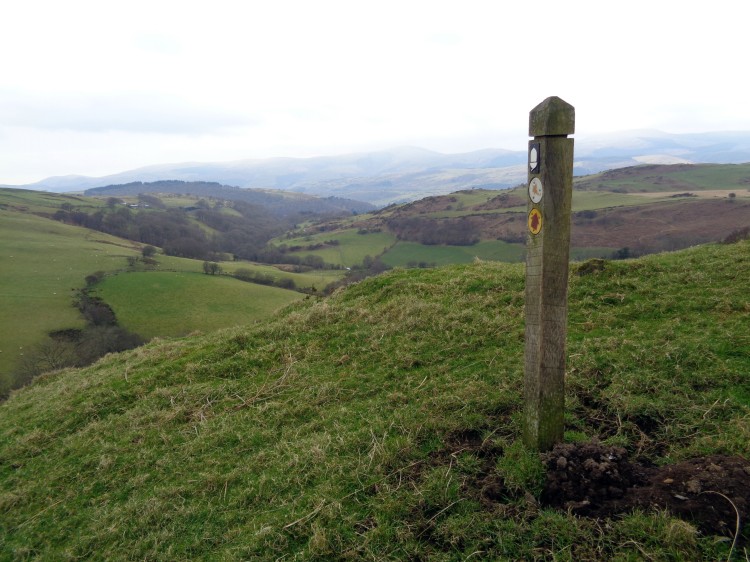
In this area you will never be far from walking on sections of  Glyndwr’s Way and we frequently came across the way marked route throughout the week. Although we are used to seeing way marks for the Wales Coast Path in odd places here was another on a hillside miles from the coast!

machynlleth-001

Look out for golf balls.

machynlleth-002

machynlleth-003

machynlleth-004

Coast Path?

This was a good introduction to the area and by luck we met Andy as we both turned into the lane leading to our cottage and in time to see Wales lose to the English.

Sunday

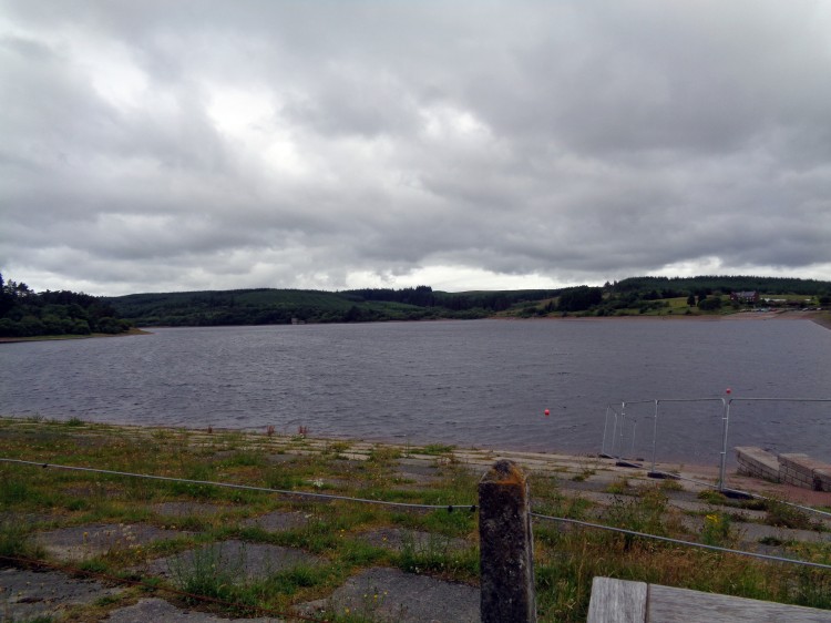
We parked in Dinas Mawddwy and walked into the valley of the Nant Maesglase.

Route

machynlleth-005

machynlleth-007

Ye olde milepost

machynlleth-006

is that snow?

machynlleth-008

The wind is blowing the waterfall uphill!

About halfway along we came a sheep who was clearly in distress and on closer examination it had caught itself up in the netting which holds bales of sileage together. We managed to turn the sheep on its side and cut through the nylon mesh and free her. We also ensured the netting was cut in numerous places to avoid a similar accidennt. From experience its not difficult  to release the bale and collect the netting.

machynlleth-009

Morning coffee break

machynlleth-010

The Navigator is happy, honest.

machynlleth-011

Snow on Maesglase

When we reached Bwlch Siglen we saw a group of walkers who turned out to be, apart  from 2 others, the only walkers we saw all week. As we climbed out of the bwlch another good deed was carried out when Andy recovered a large ripped party balloon which was caught up in the gorse. Do purchasers of these items  give any thought to what happens to these balloons when released?

machynlleth-012

We left the good paths and bush whacked across to Llyn Foeldinas in misty conditions and then back to the car via the disused quarries following a tea break in a welcome bus shelter.

machynlleth-014

machynlleth-015

machynlleth-016

machynlleth-017

Sleeting.

Monday

Today’s route would take us to Glaslyn south east of Machynlleth. The lanes in this are are narrow and parking is not easy to find but we found a suitable spot south of Aberhosan near Nantyfyda farm.

Route

We followed Glyndwr’s Way on a good path gently rising to take us to Glaslyn where we had lunch on the beach. The lake and surrounding area is now a nature reserve run by Montgomeryshre Wildlife Trust.

machynlleth-018

machynlleth-019

machynlleth-020

machynlleth-021

machynlleth-022

machynlleth-023

machynlleth-024

machynlleth-025

machynlleth-026

Lunch on the beach.

After lunch we retraced our steps to join a minor road to the viewpoint dedicated to Wynford Vaughan Thomas. The views were not extensive because of the misty conditions but the panorama plate indicated the views are there to be seen on a clear day.

machynlleth-027

Sustrans mile post route NCN 8

machynlleth-028

machynlleth-029

The byway also shown  as a cycle route albeit not one for a road bike, was followed to the village of Aberhosan and then south back to  the car.

machynlleth-030

Tuesday

Cwm Cywarch was to be our destination today and then up onto Craig Cywarch.

Route

We drove to Dinas Mwyddwy and then up to the end of the road of the  Cywarch valley where the National Trust have made a small car park with an honesty box. There is even a porto loo nicely contained behind a dry stone wall.

machynlleth-031

machynlleth-032

machynlleth-041

We came down this path

The path up is a good quarry road and then a reasonable track up onto the ridge of Craig Cywarch where the temperature had fallen with ice forming on the grass and rime ice on the fences.

machynlleth-033

machynlleth-036

Brrrr

machynlleth-037

No this is not sheep wool.

As we climbed higher snow was underfoot and here we enjoyed lunch. The cloud was now down and we followed a fence line before taking a bearing to Llyn y Fign.

machynlleth-038

Ice with that sir?

As we started to descend steeply to the path which would take us back to the car I lost my footing and crashed head first on to a very hard rock. Thankfully as it was cold I had some thick covering on my head and was able to carry on without a problem. The fall did leave a large grazed area which my dear brother-in-law said put him in mind of the ex Russian president, Gorbachov! We took the rest of the descent very slowly and there were no further incidents.

machynlleth-039

Wednesday

The forecast was poor and it seemmed sensible to stay off the hills and we headed for the coast at Aberdovy and the low hills behind the seaside town.

Route

It was a little wet to start but overall it was a fine day and the forecast was not that accurate.

We parked just outside Aberdovey adjacent to a cemetery, not the best choice for us aged walkers!

The route took us east on a gentle rising path where we joined a minor road near Erw Gwenllian. Part way along we stopped for morning coffee with views over the Dyfi estuary and on to Borth.

machynlleth-042

Leading up from the coast
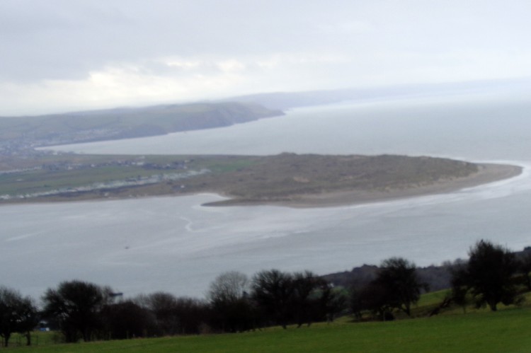
machynlleth-043

Dyfi estuary

We carried on the road to its end and then turned on to a path for about half a mile before striking north to have lunch looking down on Llyn Barfog (the Bearded Lake).

machynlleth-044

machynlleth-045

Lunch over looking Llyn Barfog

machynlleth-046

Our return was now west along a path, muddy in places thanks to the sheep feeding area and down to the road along Happy Valley.

machynlleth-047

The road along Happy Valley

At spot height 53 we joined the by way which led us down to the main road which we crossed and on to the golf club and back to the car.

Thursday

Waun Oer

This was to our “wet day” although I don’t recollect  the forecast saying that.

Route

This walk was again in the Maesglase area with the high point being Waun Oer.

We parked in the marked car park near spot height 363. It’s always good to let the car gain some height!

machynlleth-048

Looking back to the car

machynlleth-049

Looking north

You will notice lots of tightly packed contour lines with some steep ups and downs. Andy of course treated it as a flat walk whilst the “Navigator” and I felt the burn. The weather was closing in but we had some good views of the steep cwms to the east.

machynlleth-050

Steep cwms

Some way from Waun Oer it was time for the full waterproofs and when we reached the cairn there were no views where we had hoped to glance Cadair Idris. We didn’t hang about and retraced our steps to have lunch in the woodland.

machynlleth-051

Waun Oer

A joint decision was to extend the walk and we followed the fence line south east to Craig Portas for more views of the cwms following the edge back to our outward walk.

machynlleth-052

Looking down from Cribin Fawr

machynlleth-053

Cribin Fawr

At the disused quarry we stopped for afternoon tea and it was here the “Navigator” realised he had left his over trousers back at the lunch stop! They are still there if anyone passes by , finds them and wishes to notify me.

machynlleth-055

Bereft of over trousers!Afon

Cursing his forgetfulness we walked on and down hill along the diagonal track in an easterly and then westerly back to the car.

machynlleth-054

Afon Cerist cwm?

We passed a group of three men on the path who were dismantling a small tent and a camp chair. Curiosity got the better of me and they told me they were plane spotters and were hoping to see an American Osprey plane but the weather had meant a cancellation. I assume this is it.

Friday

Our last day and still standing and we were off south of Machynlleth to see waterfalls and wildness.

Route

We drove to the end of lane and walked through the farm,Cwmyrhaiadr (755964). The waterfalls  are signposted and its about a mile and quarter along first a good track and then deteriorating to a wet muddy one before a stiff climb to the top of the fall.

machynlleth-067

machynlleth-058

Towards the waterfall

machynlleth-059

Closer now. Our path can be seen in top left

machynlleth-060

Mine machinery?

The climb starts at Llechwedd Melyn and then diagonally south west. The week’s walking was now taking its toll and the first climb I found tough but then recovered as the climb eased.

machynlleth-061

Looking back from the top of the climb

Once at the top we headed for Llyn Penrhaeadr where lunch was eaten.

machynlleth-062

Five locks!

machynlleth-063

It would have been easy to have a doze here but it was not to be.We retraced our steps and walked through the woods to Hafodwnog and along the path towards Pen y Darren and then along and down through Bwlch y Groesen to the car.

machynlleth-064

machynlleth-065

machynlleth-066

The end of a good week of walking with reasonable weather and when the Viewranger stats were added up we had walked about 50 miles and climbed 12700 feet.

Bike Pack in the Brecon Beacons

I was looking for a route to  bike pack and I had recently come across a cycling route from Llandeilo to Abergavenny using minor roads and the Momouthshire and Brecon Canal.

Here are the details

I did not plan to cycle the whole length but decided to start in Sennybridge which would give me some 30 plus miles with an additional mileage off the route to the campsite at Pysgodlyn Farm.

Being retired I have the luxury of choosing a weather window, which recently was proving difficult as summer has forgotten to put in an appearance. However here was a chance and I took it although as I drove into Sennybridge I was met with a hail storm which thankfully soon passed and rain was not seen for the  rest of the trip.


All packed

101_1992

Corn Ddu and Pen Y Fan

The first 9 miles are quite lumpy which was not too bad with fresh legs but on the return were hard work.

I had a coffee break in Brecon before joining the  canal tow path which took me to Pencelli where I again joined the road.

101_1993

Coffee at Brecon

101_1994

Canal side homes

101_2001

101_1995

River Usk from aquaduct

101_1996

An owner from the 60’s?

101_1999

Lime kilns

101_2000

A redwood


En route I had a puncture caused by a drawing pin, hopefully not left to cause annoyance but just a stray incident.  Some 2 miles after Llangynidr the tow path was joined until I arrived at Gilwern where I rejoined the road to head for the A40 and my camp site for the night.

I can recommend Pysgodlyn Farm. It is a flat site with good facilities although for some there is no local pub unless you decide to ride or walk into Abergavenny. From my tent there were good views of the Blorenge.

101_2004

The Blorenge

My tent was soon erected and I was looking forward to a coffee but to my horror my lighter was empty and it was impossible to light the meths burner with a fire stick. Thankfully the farm owner lent me some matches and a friendly camper gave me a Bic lighter to keep and all was well with the world.

101_2003

Home for the night

101_2002

Kitchen

The following morning breakfast was eaten and I was soon on my way down to Abergavenny looking to join the tow path which I had decided I would follow all the way back to Brecon. The canal was quite busy with numerous narrow boats and a  few  boats hired by the hour.

101_2006

101_2007

101_2008

Llangatwg escarpment

101_2009

Future sausages

101_2011

Hills above Crickhowell

101_2012

Locks at Llangynidr

101_2013

101_2014

We won’t be seeing these again!


I stopped at Talybont on Usk for lunch but there was a mild panic as my wallet was not in its usual place. Whilst emptying the panniers a kind lady in a small camper van offered to buy me coffee – this shows there are more good people than bad in this world. However my wallet was hiding at the bottom of the bag and I was able to pay my own way.

101_2015

Lunch at Talybont

At Brecon after some 25 miles of flat pedalling I faced the hilly lanes back to Sennybridge, my very own Mont Ventoux! I made it and soon loaded up the car. An enjoyable two days and perhaps the rest of the route can be undertaken a little later.

Monmouthshire and Brecon Canal

At last Judy and I were able to arrange a mutually convenient day for a paddle on the Monmouthshire and Brecon Canal .

This was the first time this year when I was able to rescue my sandals from the shoe cupboard. It was a lovely day with spring flowers along the canal side and young ducklings skittering along the water.

101_1829

We launched at Talybont On Usk and headed west. The tow path was fairly busy with walkers and cyclists one of whom for whatever reason was wearing one of those life jackets which inflates when it hits the water. I can only assume his cycling skills left a lot to be desired!

There were good views of the Brecon Beacons with Pen y Fan standing tall.

101_1830

One of the narrow boats moored up was called the Hannah Snell, click the link for her details, very odd.

101_1833

Back at Talybont we reloaded the canoe and retired to the cafe for coffee and cake.

101_1831

Llyn Clywedog

One of the volunteer jobs I help Many Tears Animal Rescue with is the occasional transporting of dogs to specialist vets.

101_1778

Thursday  I travelled to Hafren Vets in Llanidloes with seven dogs. The surgery has a specialist in bone surgery and each of the dogs either has leg problems or broken jaws.

It would take several hours to assess all the dogs and as it was a fine day I travelled a short distance to Llyn Clywedog an area I had not been to previously.

101_1774

The views were fantastic and with lunch packed into a rucksack off I went for a short walk. I came across Glyndwr’s Way and followed this for a short while and then joined the interpretative trail laid out by the Severn Trent Authority.

101_1773

101_1776

101_1761

101_1762

101_1765

This led down a finger of land sticking out into the lake. At the end I came across a party of young children being taught to sail. There was a brisk wind blowing but they were doing very well.

101_1766

The ridge I walked down

101_1768

I had a lazy lunch, read a little and looked at the views before heading back via a path close to the water.

101_1769

Judging by the numbers of lambs these boys had been busy


101_1770

101_1775

Old lead mines

101_1777

No cake today

Back at the vets I was told they would keep 2 dogs for urgent operations and the rest would need to return in due course.